DataHaven
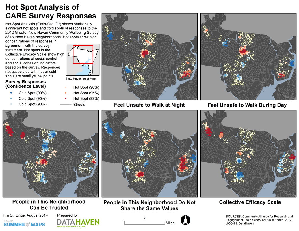
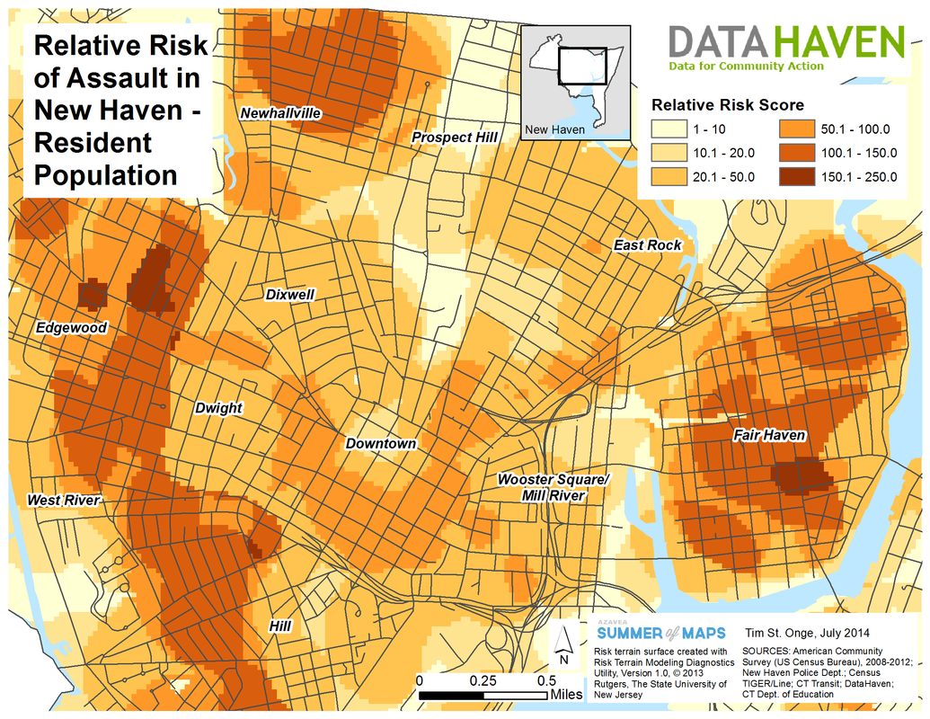
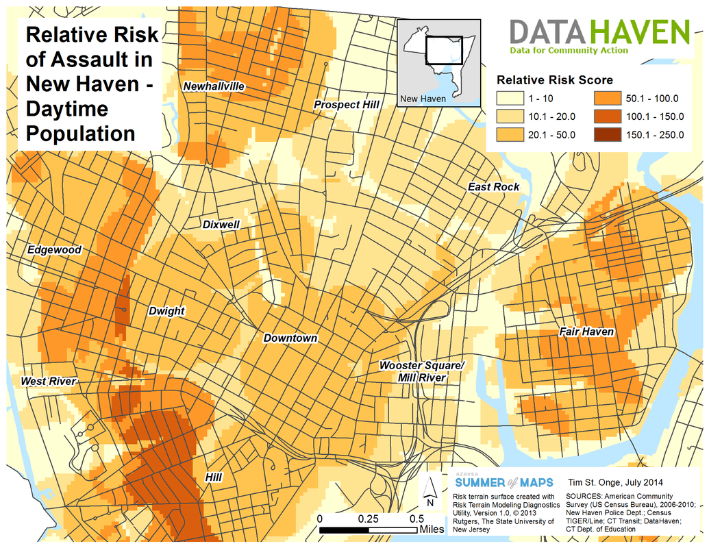
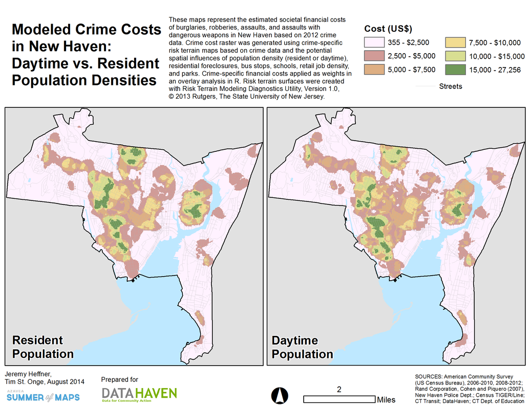
As part of my fellowship with Azavea's Summer of Maps program, I worked with DataHaven, a New Haven, Connecticut-based non-profit working to compile, analyze, and share public data related to community well-being in order to improve local policymaking and educate the public. Incorporating data on local crime as well as potential risk factors for crime such as bus stops and vacant homes, I used risk terrain modeling software and GIS analyses to map and analyze patterns of crime risk in New Haven. In addition to visualizing risk terrains by crime type and population density, I mapped local survey responses to gauge links between crime risk and public perceptions of neighborhood social capital and safety. My work with DataHaven also included a separate analysis of recent historical trends among foreign-born immigrant communities in Connecticut.