Flooding Risk in Bangladesh
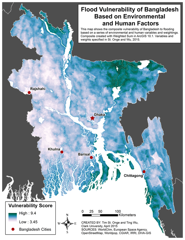
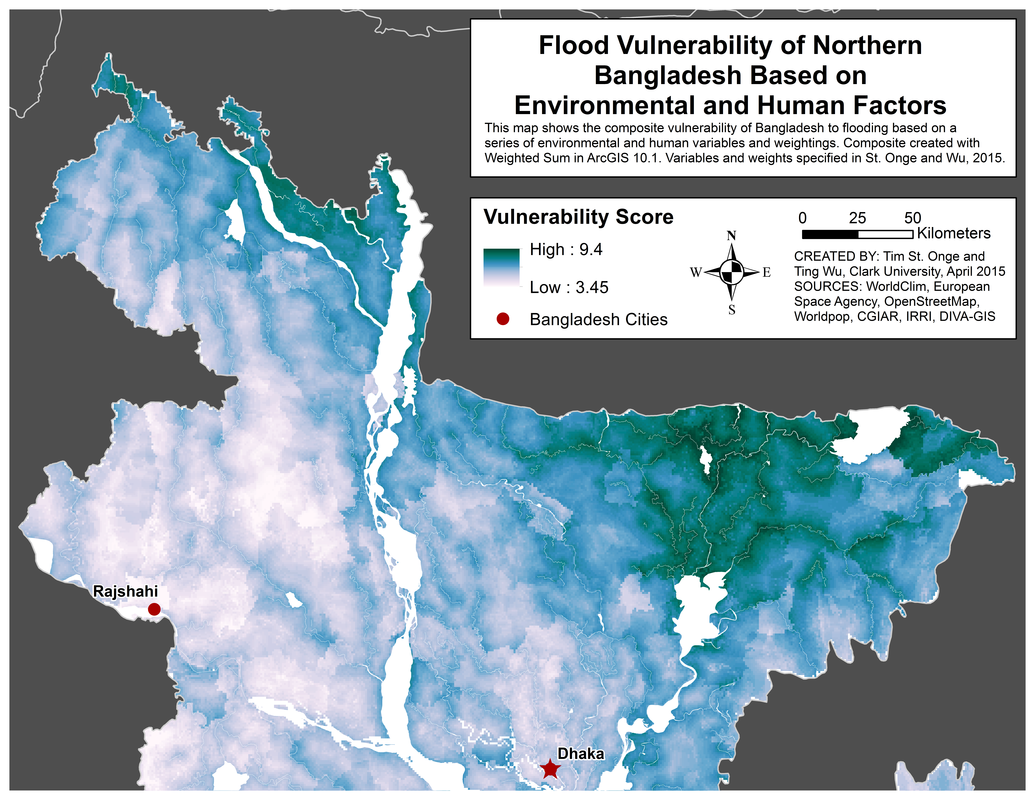
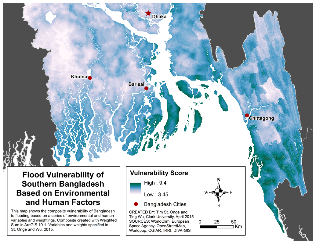
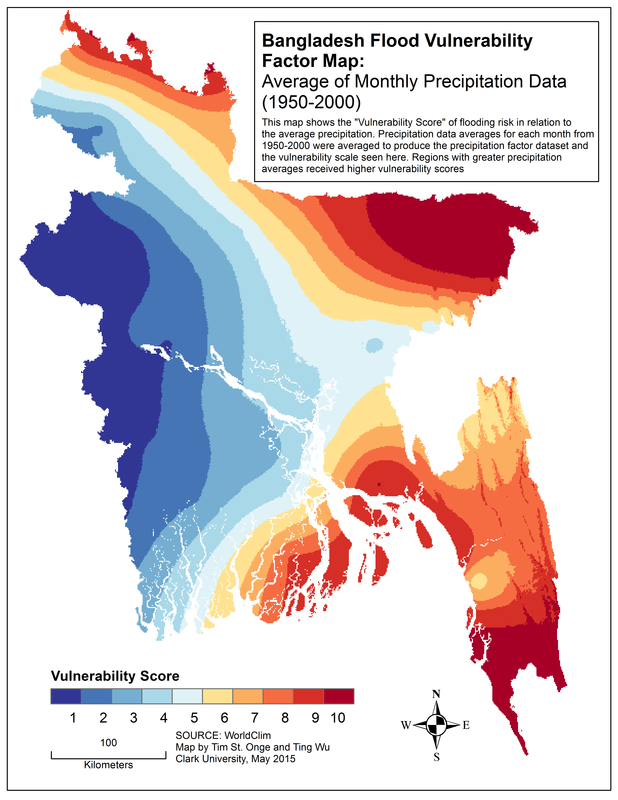
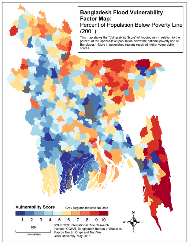
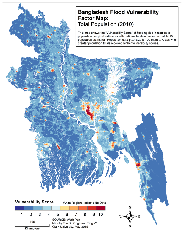
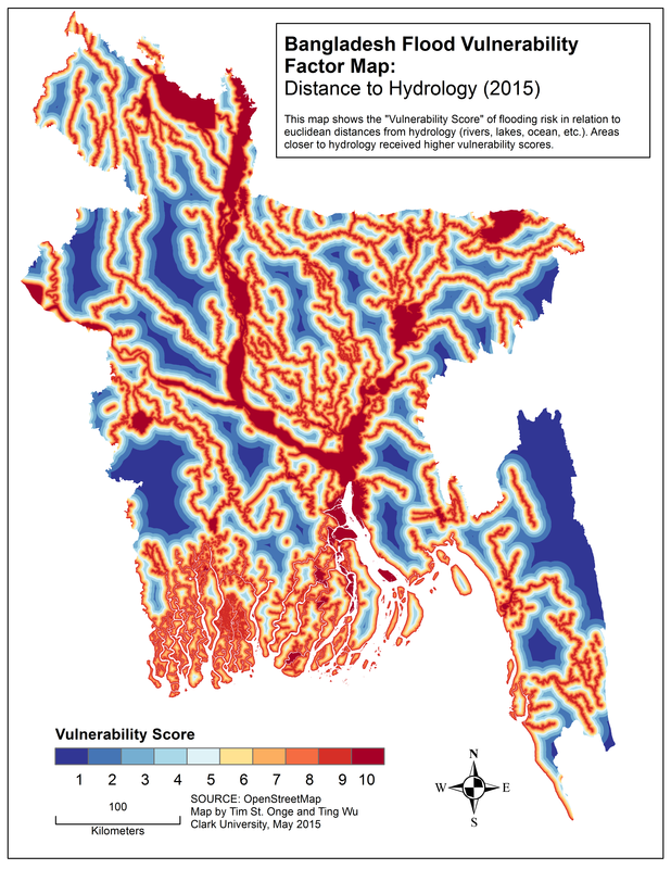
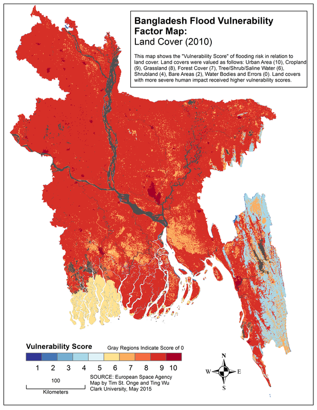
Ting Wu and myself studied the geography of flooding risk in Bangladesh with respect to environmental factors conducive to the natural hazard as well as human factors that strongly influence a hazard's impact on infrastructural damage and loss of life. After collecting and rescaling spatial datasets for a range of factors, we performed a "weighted sum" analysis which produced a composite map of the overall effects of combining each factor's vulnerability patterns. The final results indicate what areas of Bangladesh may be at the greatest relative risk for flooding hazards that could severely devastate local human populations. Understanding the geographies of natural hazard risk from both environmental and human perspectives should be an important consideration for governments and organizations involved in disaster prevention, mitigation, and response.