Natural Hazard Risk in Haiti
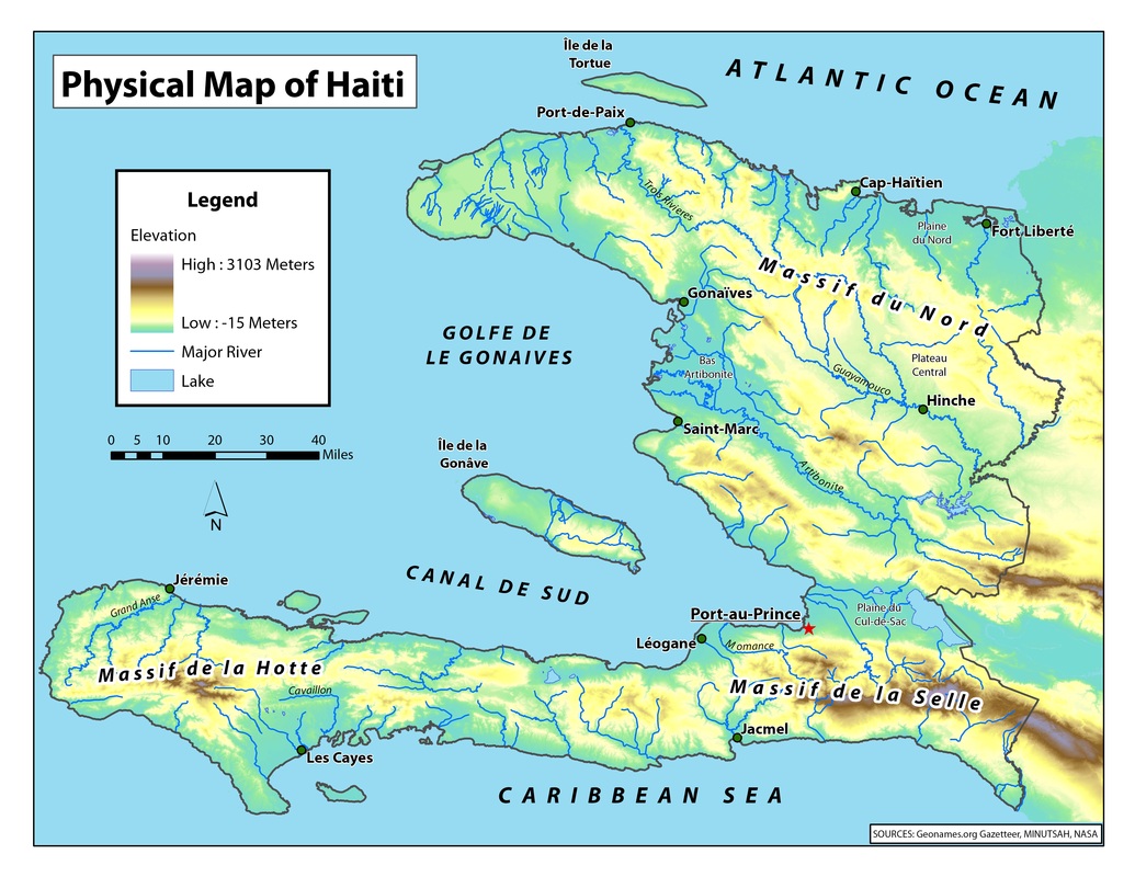
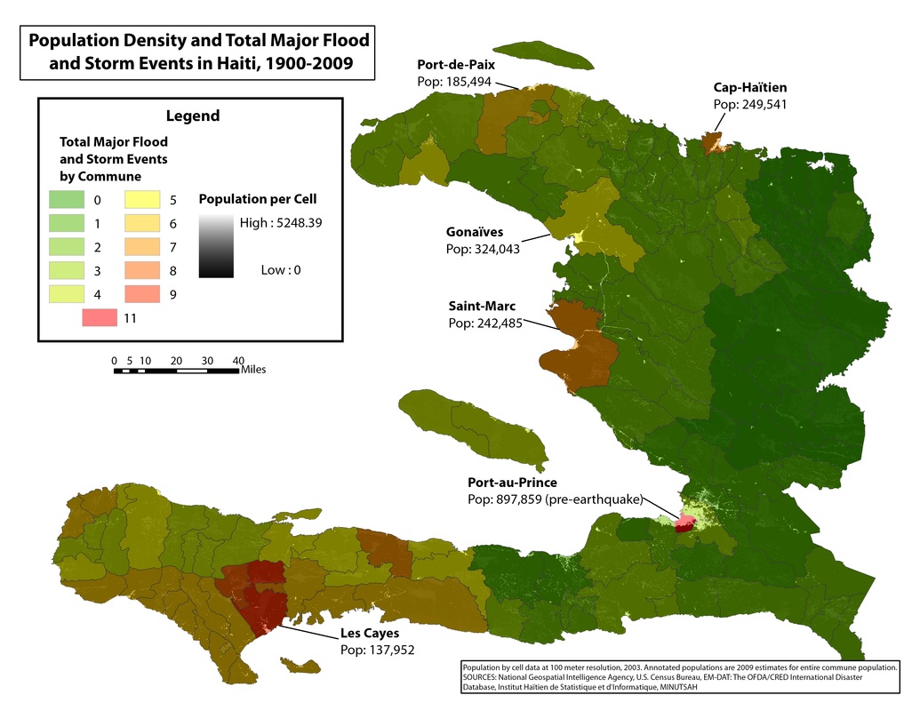
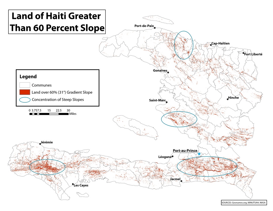
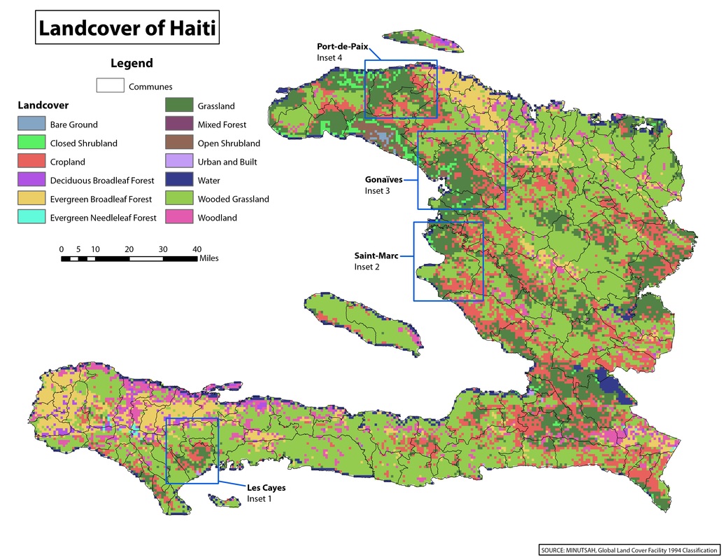
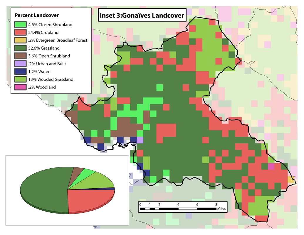
For my GIS Capstone Project at the University of Mary Washington, I studied the physical and human geographies of Haiti in order to map levels of risk across the country for natural hazards such as earthquakes, hurricanes, floods, and landslides. This project grew out of cartography work I was engaged in during an internship with the Geography and Map Division of the Library of Congress. I used physical geography concepts and ArcGIS tools in raster analysis and cartography to map slope steepness, land cover classifications, and storm and flood records that illustrated degrees of vulnerability to natural hazards across the country.