Park Access in Philadelphia
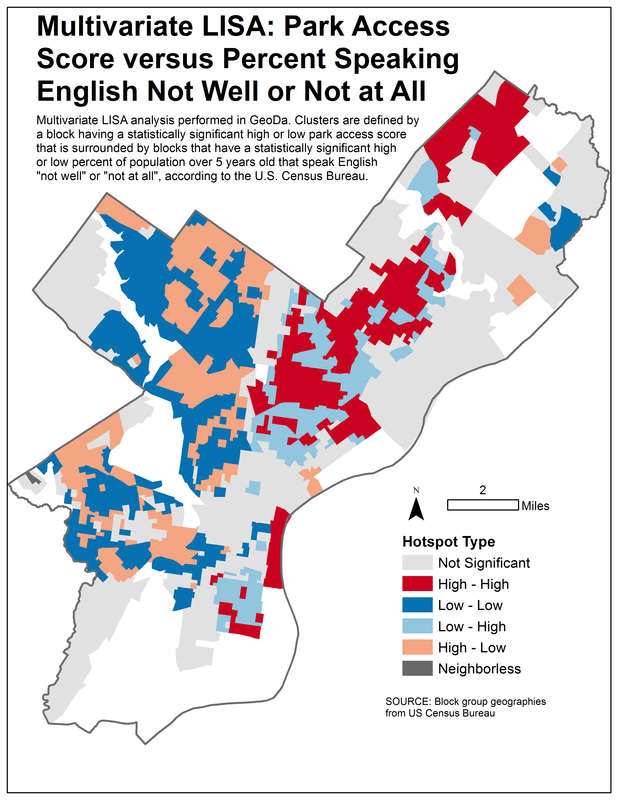
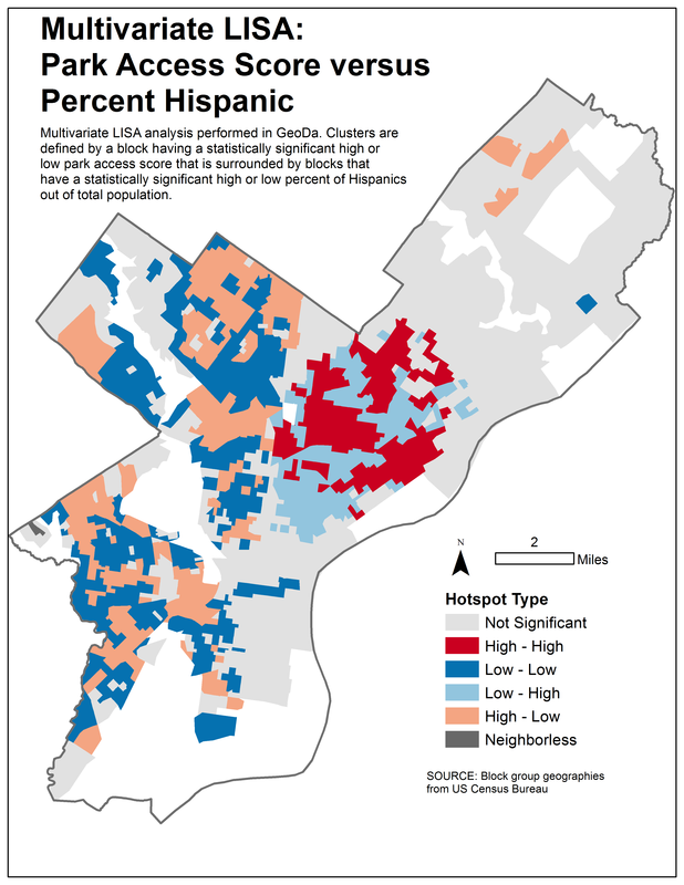
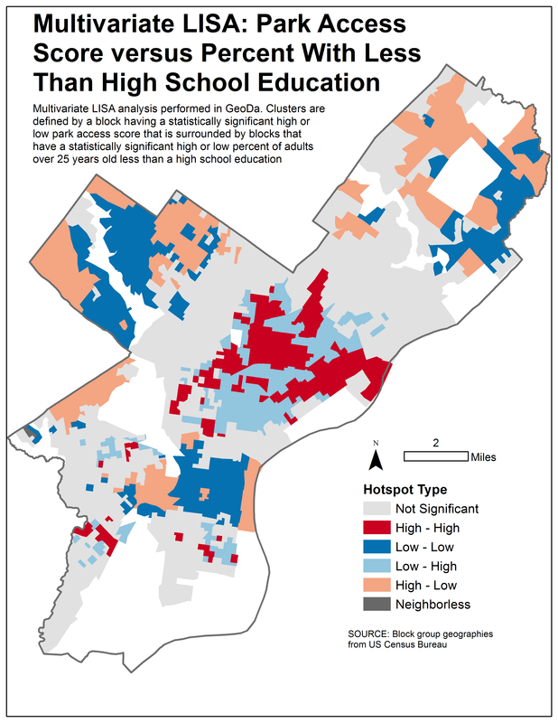
For my final research project for my Intermediate Quantitative Methods in Geography course, I examined urban park access in Philadelphia and used spatial and non-spatial statistical methods to examine possible relationships between block group-level socioeconomic conditions and inequalities in park access. My objective was to test a finding that has been observed in other environmental justice research: that neighborhoods with more racial minorities and conditions of poverty have more limited access to park space than more affluent, racially white neighborhoods. Borrowing from park access insights gained from my Summer of Maps fellowship with Azavea, I created a street network-sensitive measure for park proximity and compared proximity values with Census data using linear regression, cluster analysis, and Local Moran's I techniques. Although the non-spatial statistical methods proved largely inconclusive, the Local Moran's I analysis identified localized areas within Philadelphia that appear to be experiencing limited park access as well as disadvantageous socioeconomic conditions. In Spring 2015, I expanded my analysis to include the census tract geography level and data from 1960 to 2010. I presented the results of this expanded study at the American Association of Geographers Annual Meeting in Chicago on April 21, 2015.