Crime Near Public Housing in D.C.
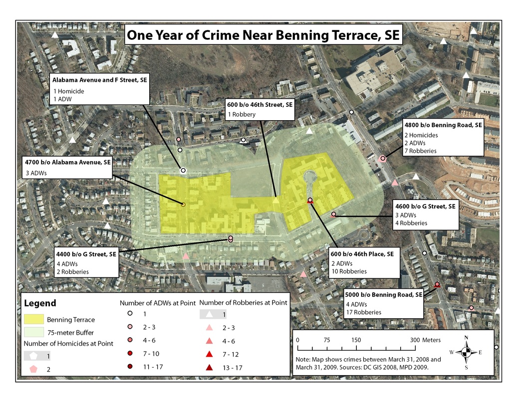
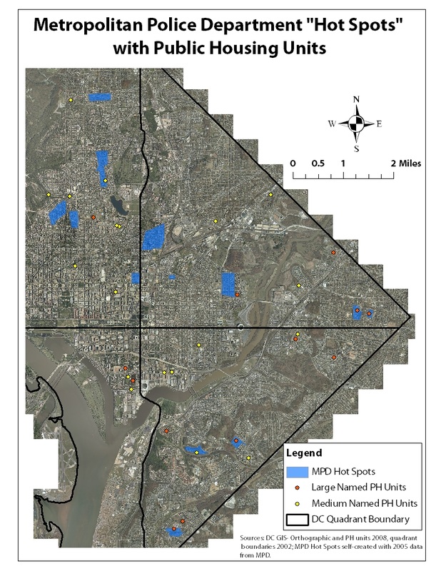
My final project in Applications of GIS at the University of Mary Washington studied crime patterns in Washington, D.C. in relation to demographics and public housing complexes. I applied ArcGIS tools to quantify and map crime incidents and demographic data corresponding to the immediate neighborhoods of public housing units. The study's hypotheses that public housing complexes were concentrated in neighborhoods struggling with violent crime were supported by the results of the research. This project was very educational for me in that it allowed me to discover GIS techniques and principles that can be applied to urban issues such as crime, poverty, and racial segregation.