Water Pollution in the Salton Sea
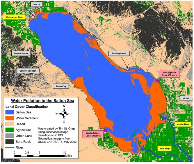
In 2009 I gained exposure to remote sensing technologies and techniques in air photo interpretation. As a final class project, I studied water pollution in California's Salton Sea. The Salton Sea is a saline lake in southern California that has no primary outflows, making it subject to heavy pollution from agricultural runoff and polluted rivers that flow into the lake. I used satellite imagery of the lake to conduct supervised image classifications in PCI Geomatica that identified portions of the lake that were experiencing high levels of pollution sediments. I was able to present this work as an Illustrated Poster Presentation at the 2010 American Association of Geographers Annual Meeting in Washington, D.C.