Urban Expansion in China
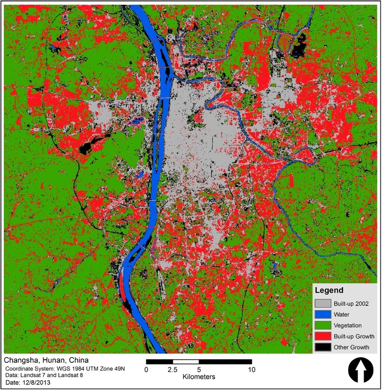
In my first semester at Clark University, I was able to further my knowledge of remote sensing techniques and applications. For our final class project, Faleh Aldham, Jiabin Heng, Holly Zanoni, and myself used supervised image classification methods in IDRISI to map and quantify the expansion of three rapidly growing Chinese cities. We then used our area calculations and economic data to try to find statistical evidence of the Chinese housing boom (ie. urban land growth disproportionate to population and economic growth). While our research methods proved inconclusive in detecting mass vacancies in urban land, the project was educational in exploring the applications of remote sensing to urban studies as well as the issues associated with rapid urbanization and human development.