Youth Arrests in Worcester
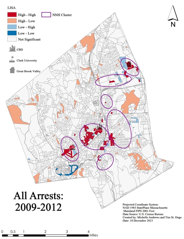
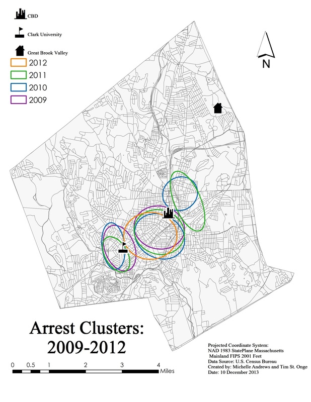
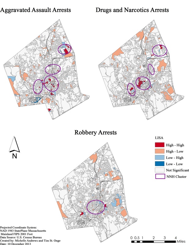
Working alongside Michelle Andrews (Clark University B.A. Geography, 2014), our final course project in Advanced Vector GIS focused on mapping patterns of youth crime in Worcester, Massachusetts. The core aim of the project was to study arrest patterns using spatial statistics. We implemented hot spot and cluster analyses using Local Moran's I and Nearest Neighbor Hierarchical Clustering in ArcGIS, GeoDa, and CrimeStat to determine statistically rigorous concentrations and hot spots of youth arrests. Our research identified neighborhoods of concern in Worcester that are experiencing severe and persistent problems with youth crime activity.